Footprints of Touch: A Journey Along Textured Trails

Today we explore Citizen Science Methods for Mapping Trailside Texture Diversity, inviting hikers, runners, and families to notice, record, and celebrate the tactile richness along paths. Together we will gather consistent observations, transform them into meaningful maps, and turn everyday walks into collaborative discovery. Expect practical field guidance, inspiring stories, and simple tools that make participation easy and rewarding, whether you carry a flagship smartphone or a well‑worn notebook. Bring curiosity, respect for living places, and a willingness to share what your hands and eyes already know.

Preparing People and Paths for Hands-On Discovery

Before data becomes a map, people become observant. A short orientation builds confidence, clarifies permissions, and sets safety expectations while modeling respect for plants, soils, and built surfaces. We emphasize staying on designated paths, noticing small details without disturbing them, and documenting textures in consistent, comparable ways. Volunteers learn how their contributions fit into the larger mosaic, why repeatable methods matter, and how to ask questions generously. Preparation turns a casual stroll into careful noticing, and careful noticing into community insight.

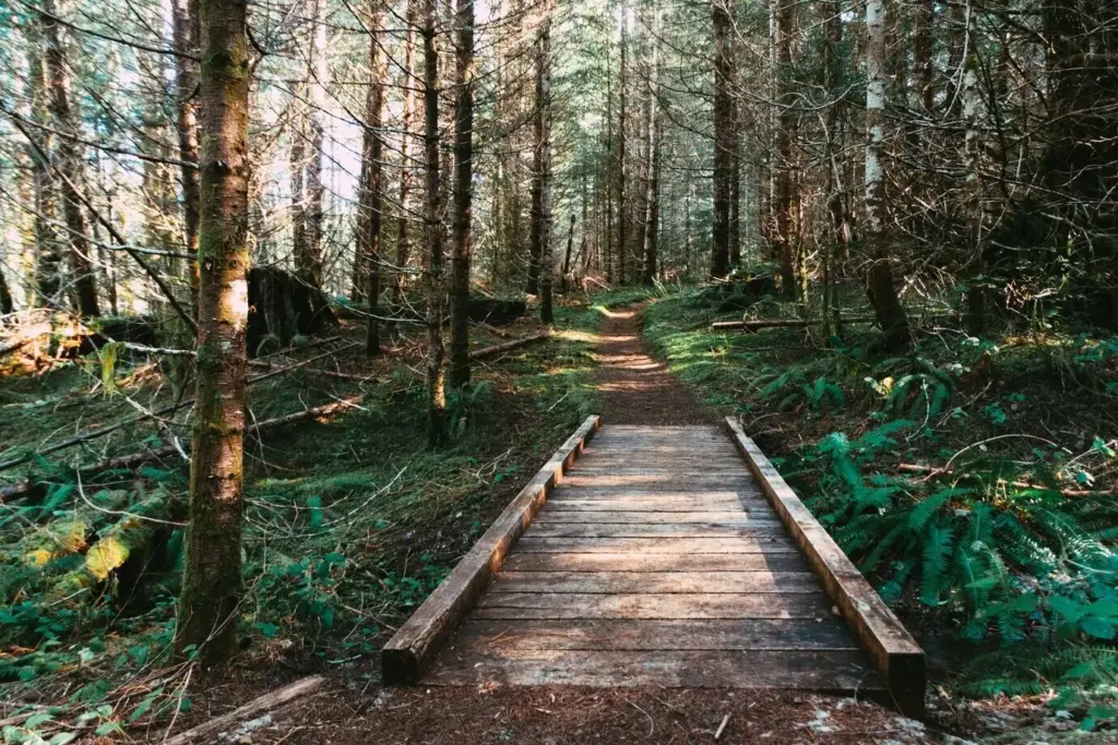
Capturing Texture with Everyday Tech and Simple Rituals

Consistent capture produces comparable maps. We recommend a repeatable sequence: photo, scale, angle, light check, short note, and optional audio reflection. Use natural light when possible, steady your hand, and include surrounding context for orientation. Keep exposures brief to maintain momentum and avoid trampling. Small rituals reduce variability between contributors and days. They also make the activity feel calm and meditative, transforming scattered snapshots into a coherent dataset capable of supporting insights about diversity, accessibility, maintenance priorities, and seasonal change.

Photo standards that make data comparable

Hold the camera parallel to the surface, fill two‑thirds of the frame with the texture, and include the scale card’s corner. Take one oblique shot to show edge transitions and one wider scene for location memory. Lock focus, avoid harsh flash, and note any shadows. Snap a quick duplicate if wind or movement blurs details. By following a short, repeatable checklist, contributors reduce noise across devices, lighting, and skill levels, enabling confident comparisons between different trails, weeks, and weather conditions.

Sound, touch, and words: multimodal notes

Textures invite more than sight. Record a ten‑second audio note describing tactile feel—grain, moisture, stickiness—and any faint sound like crunch or rustle underfoot. Add brief written descriptors using shared keywords for later filtering. If appropriate, describe gloved touch impressions without pressing or scraping. Multimodal notes capture nuance photos miss, helping analysts interpret ambiguous patterns, such as slick clay over pebbled base or flaking paint on rough steel. Diverse inputs strengthen future training datasets and improve community understanding.

Build a living lexicon together

Invite contributors to submit candidate terms with paired images and short definitions. Host periodic reviews where the community merges duplicates, clarifies overlaps, and retires rarely used labels. Provide translation notes for multilingual groups. Keep examples current as seasons shift and maintenance alters surfaces. A living lexicon helps everyone speak precisely without policing creativity, ensuring new textures—charred bark after a burn, frost‑flowered mud, resinous sap films—enter the vocabulary thoughtfully, with guidance that preserves comparability while welcoming discovery.

Consensus labeling with gentle guardrails

Use lightweight peer review for tricky entries: a small set of volunteers suggests labels, then the system highlights common choices while preserving dissent. Offer tooltips with look‑alike distinctions and quick quizzes that teach through examples. Provide immediate, kind feedback rather than silent rejection. Over time, contributors internalize distinctions—like cement skim over gravel versus crushed limestone—and label more consistently. Guardrails cultivate confidence, deepen skill, and build trust, so the dataset gets cleaner as the community grows more capable.

Embracing hybrids and edge cases

Real trails rarely fit tidy boxes. Allow multi‑label entries, edge annotations, and transition markers where roots, boards, and silt braid together. Encourage notes about recent events—fresh grading, stormwash, freeze‑thaw heave—that produce temporary textures. Flag sensitive biological crusts for special handling. Rather than forcing a single label, store structure that preserves ambiguity for later analysis. Embracing edges reflects how people actually move, feel, and decide, enriching navigation guidance, restoration planning, and maintenance scheduling with honest, context‑aware information.

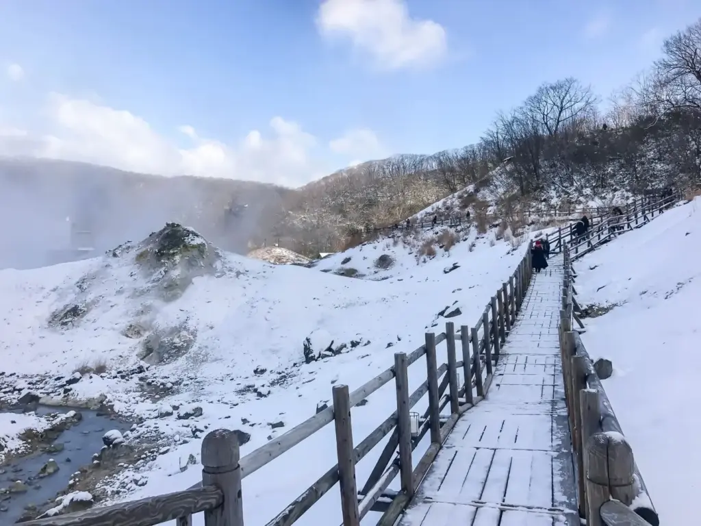
Reliable Maps from Unruly Places

Trails challenge sensors with canopy, canyons, and metal structures. Improve location quality using waypoint snapping to official paths, buffered error estimates, and gentle prompts to pause for a stronger fix when safe. Cache basemaps for offline use, and synchronize later to avoid data loss. Deduplicate overlapping entries by comparing time, place, and content similarity. Clear workflows transform scattered observations into credible layers, letting communities explore hot spots of richness, slippery segments after rain, and maintenance needs without technical barriers.

A small story of curiosity changing a route

On a rainy weekend, a family noticed a slick clay section where stroller wheels fishtailed. They recorded photos, a brief audio note, and a simple traction rating. Weeks later, after community review, the park added a gravel cap and drainage grooves. The family returned, repeated the observations, and celebrated the difference. This gentle cycle—notice, share, learn, improve—captures why mapping textures is not abstraction. It is neighborly care, grounded in lived experience and tangible, safer steps.

Designing participation for many kinds of bodies

Plan gentle routes, frequent rests, and clear meeting points. Offer tactile scale cards with raised lines, big‑print instructions, and voice‑controlled capture options. Encourage buddy systems that pair note‑taking with observation leadership. Respect pace variations and energy limits, shaping sessions that end with celebration rather than exhaustion. When participation welcomes mobility aids and different sensory styles, data becomes more inclusive and insightful. Diversity in contributors reveals diversity in textures, enriching maps that guide planning, signage, and shared delight.

Turning observations into safer, richer trails

Share findings with maintenance crews, disability advocates, and local councils through concise briefs and annotated maps. Highlight quick wins—patch a slippery corner, trim roots nudging boards, add a handrail at a steep turn—alongside longer plans like resurfacing. Invite follow‑up walks to confirm improvements and catch unintended consequences. Measure change with before‑and‑after observations so investments remain transparent and accountable. When community knowledge flows into action, trust grows, and trails become welcoming classrooms for touch, balance, and belonging.

From Dots to Decisions and Shared Wonder

Analysis should be honest, understandable, and useful. Start with descriptive summaries—counts, diversity richness by segment, moisture patterns—then layer simple indices and heat maps. Compare seasons and after‑rain states to everyday conditions. Avoid overpromising while celebrating meaningful shifts confirmed by repeats. Finally, share story maps that blend numbers, photos, and voices, inviting comments and co‑interpretation. When people recognize their entries in the narrative, they return, contribute more, and invite friends. Discovery becomes habit, and habit sustains stewardship.
Visualize texture richness per hundred meters, distribution of moisture states, and frequency of mixed surfaces. Use transparent formulas and explain limitations plainly so insights feel trustworthy. Provide downloadable summaries for planners, educators, and curious neighbors. Spotlight a few segments where patterns invite action or celebration, then request targeted follow‑ups. Clear, respectful reporting builds confidence without obscuring uncertainty, creating a shared foundation for decisions that honor both human comfort and ecological integrity along much‑loved paths.
Repeat scans each season, after big storms, and during freeze‑thaw windows. Compare how bark roughness, soil firmness, and leaf litter stability change, and which combinations challenge different users. Interactive timelines help volunteers watch textures breathe across months, turning anecdotes into patterns. This rhythm reveals maintenance windows, educational opportunities, and moments for caution signage. Seasonal understanding turns reactive fixes into gentle, timely care, aligning human schedules with the living pace of trails and the materials that compose them.
Join a return walk, adopt a favored segment, or mentor first‑time contributors. Share reflections on what feels clear or confusing in the methods, and propose improvements. We welcome photo essays, audio postcards, and classroom projects that expand the conversation. Subscribers receive gentle prompts for seasonal updates and mini‑challenges that keep curiosity fresh. Co‑authored summaries credit contributors by choice, recognizing the generous work that turns scattered moments into maps that guide care, access, and everyday wonder.
Nuxuzefirapomonazi
Privacy Overview

This website uses cookies so that we can provide you with the best user experience possible. Cookie information is stored in your browser and performs functions such as recognising you when you return to our website and helping our team to understand which sections of the website you find most interesting and useful.